Fuad's Trip Account
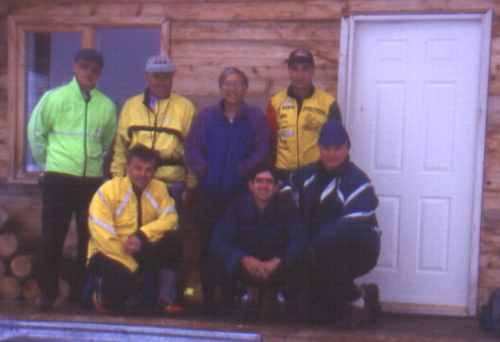
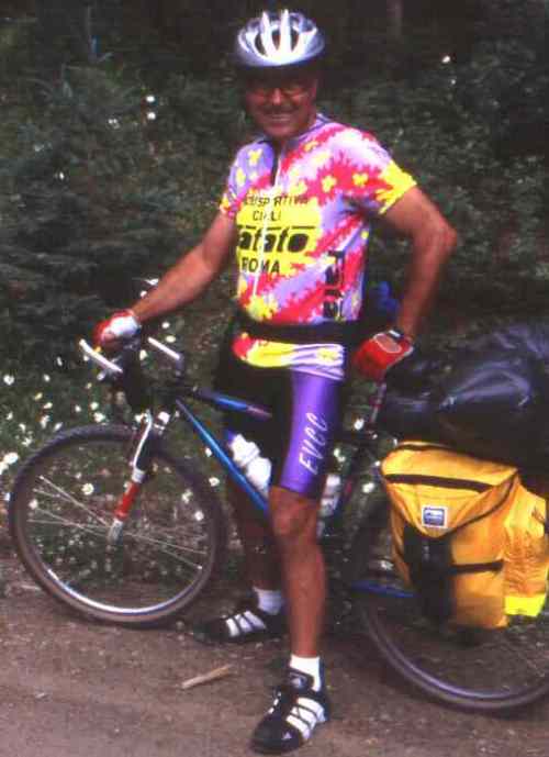
Seven of us started on what Peter promised would be a great adventure: Peter (coordinator, adventurist, dreamer), Len, Vic, Paul (token Aussie), Mike(tough guy), Jim and Fuad (reporter). Having just joined the Club for this trip, I was assigned to write a trip report. I assumed that writing a trip report is just part of the initiation process.
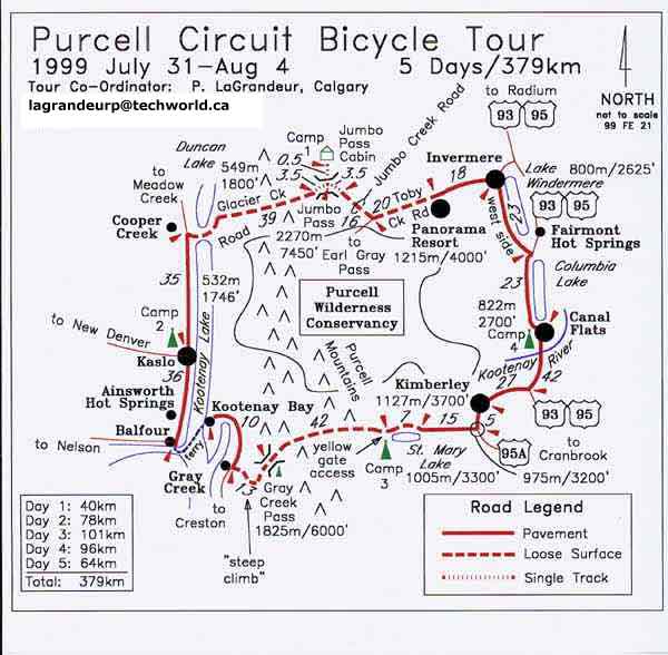
This five-day self-supported trip, a brainchild of Peter's, is a circuit of the Purcell Wilderness Conservancy Park in south BC. It starts from Panorama Ski resort, follows logging roads west, crosses the main range of the Purcells over Jumbo Pass (2,270 m) and drops down to Duncan Lake. It then goes south along Highway 31 on the West side of Kootenay Lake through Kaslo, to the Crawford Bay ferry and to Grey Creek. It then climbs back east via a logging road to Grey Creek Pass (1,825 m), drops down to St. Mary river, then to Kimberley, Highway 95 north and back to Panorama.
Looking at the map, it appears as a natural line to take; I think there used to be an old route that went west to Kootenay Lake over nearby Earl Grey Pass, a hike I wanted to try years ago. Originally, Peter's plan was to go over Earl Grey Pass but was told by the BC Forestry Service that no biking is allowed over this pass and was diverted to Jumbo Pass. The total distance is about 400 kms, of which 144 kms are over gravel logging roads and about 10 kms on a hiking trail. More important is the vertical distance: 1,112 m to Jumbo Pass and 1,293 m to Grey Creek Pass, not counting the usual ups and downs on the highway and the final climb of 380 m to Panorama.
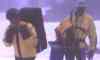
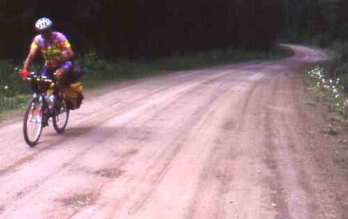
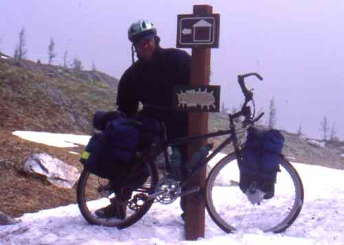
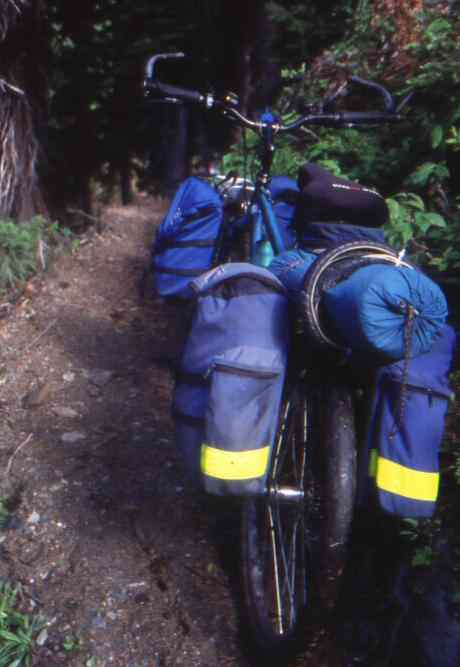
We had to carry tents, sleeping bags, foamies, stoves, fuel and food for two days with us. Having hiked and climbed in the area, I was concerned about getting to Jumbo Pass with camping gear and bicycle, so Jim and I decided (wisely as it turned out) to start up Toby Creek road from Panorama on Friday evening after an early supper at the Panorama golf course. Everybody else started at 9:00 AM Saturday for the 36 kms cycle and 5.5 kms hike to Jumbo Pass.
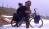
We set off around 6:30 PM with loaded bikes intending to camp in an hour or two, but the going was so good that we did the 20 kms along Toby Creek and went a further 6.5 kms along Jumbo Creek before setting up our camp at around 9:00 PM. The cycling was excellent, the scenery beautiful and the conditions ideal. The main logging road along Toby creek continues to Mt. Toby and Earl Grey Pass, an area I had hiked into some 25 years ago.
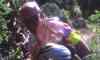
There was plenty of fresh evidence of bears, so I had my bear bell out and Jim wisely let me forge ahead; coming around a curve, I stopped to watch the black animal 100 metres ahead and decided to wait for reinforcements. On arriving, Jim assured me that it was just bear shit; he was focusing on the fresh droppings next to us and was unaware of its author watching us.
Happily, we reached a mutual non-aggression pact with bruin and he ambled off into the woods, presumably in search of tastier prey while we continued on our way with an occasional look back. That night, as a precaution, we hung our food from the bridge over the creek as we could not find a suitable tree.
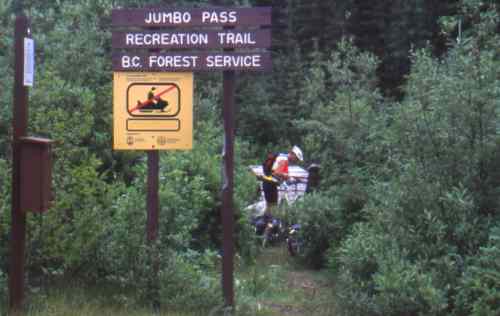
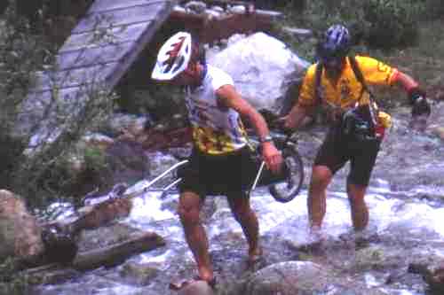
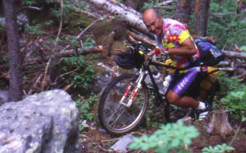
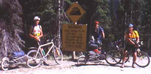
The next morning, Saturday (day 1), we were off around 8:30 AM for what we knew would be the toughest day. Our spirits were high as the remaining 9.5 kms along the road to the Jumbo Pass parking lot continued to provide excellent and enjoyable cycling, even with full loads. However, sooner or later, all good things must come to an end. The hiking trail starts with a creek crossing and the bridge was out; this we knew and we had come prepared with wading shoes. It looked like we could ride the trail ahead. But this was not to be; in about 50 m, there was another creek crossing and a washed-out bridge. we went through the same routine with the wading shoes, wanting to keep our shoes dry, little suspecting that it would be all for naught. Now the trail got rougher as it started climbing in earnest, and even pushing the bikes got to be very difficult, but naively we kept hoping that we would soon be riding, until in about an hour the trail got very rough with big rocks as it climbed above a cliff. More rocks and
deadfall followed.
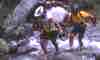
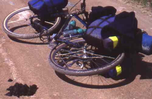
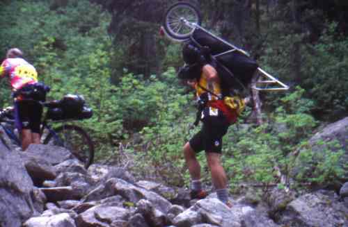
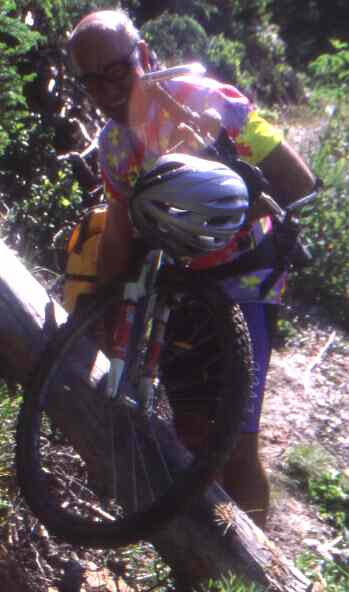
Finally, we admitted defeat and took off our panniers. From there on to the pass, we continued taking our loads and bikes in relays, each time leapfrogging, thus doing the hike three times. We had to push, pull, drag, carry, cajole, kick and curse our bikes for the next 4 kms. To add to the fun, the mosquitoes were ferocious and hungry.
Several times the trail seemed to level out, but it was just teasing us; it continued relentlessly uphill. The difference was now there was snow on the ground, first patches of soft wet snow, then more snow with wet meadows and water everywhere. In no time, our shoes and socks were soaking wet, making a mockery of our earlier efforts to keep them dry. But by then we couldn't care less, we just wanted to get to this over with; until then, I had not realize how hard it is to push a bike in wet snow and to jump over creeks carrying one, especially in cycling shoes.
At last, when I was thinking that this nightmare would never end, the trail started going down; we had reached the Pass. Now we could get rid of the damned bikes and hike to the cabin encumbered just by our panniers. It was around 5:00 PM, and it had taken us six to seven hours to cover the 4 kms, having hiked about 14 kms and about 2,000 m up and 1,000 m down. This part of the trip was enjoyable but only in a masochistic way and is best described as "character-building".
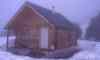
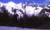
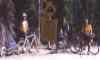
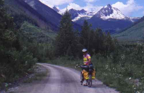
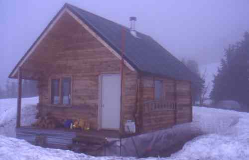
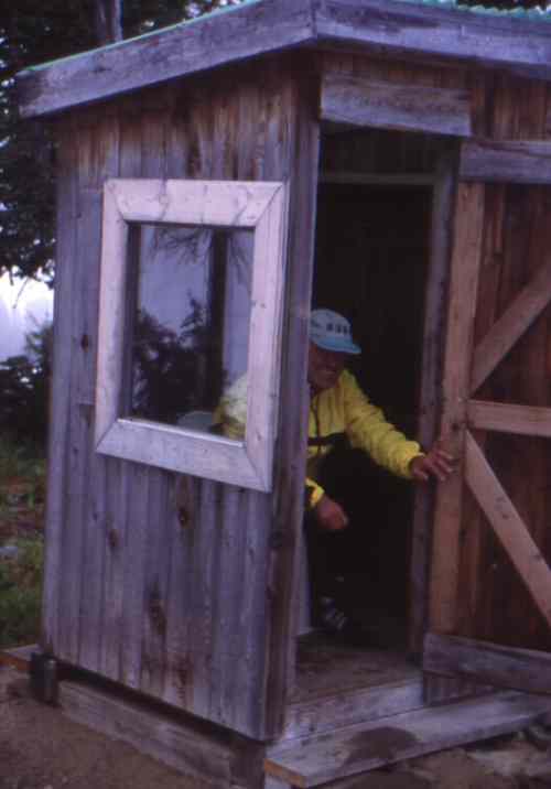
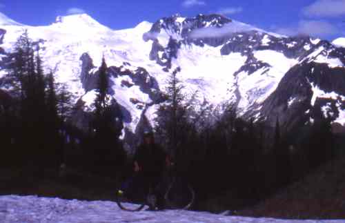
The hike to the cabin was about .5 kms, mostly over snow and was delightful without bikes. The scenery was magnificent with glaciers coming down from the surrounding peaks, Mts. Jumbo and Karnak to the north-east, Mt. Earl Grey to south-east, Mts. Truce and Cauldron to the south-west and the Macbeth group to the west. It was also cold with about four feet of snow at the cabin.
By 6:00 PM, Jim and I were settled in with the stove going speculating as to when the rest of the party would be getting in; we knew that two people had trailers and we were wondering how they were managing. By 8:00 PM, we were discussing what to do if nobody showed up and we both agreed to carry on as we did not want to go down the way we came up. I think it was close to 8:30 when Paul showed up and, one by one, the rest straggled in. They had started from Panorama at 9 o�clock in the morning and had cycled 26.5 kms more than we did, so they had a harder day. As Paul put it, "it was brutal" and we all agreed. By contrast, the rest of the trip was an anti-climax, still hard but we could ride or at least wheel the bikes with the panniers.
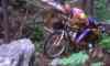
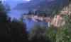
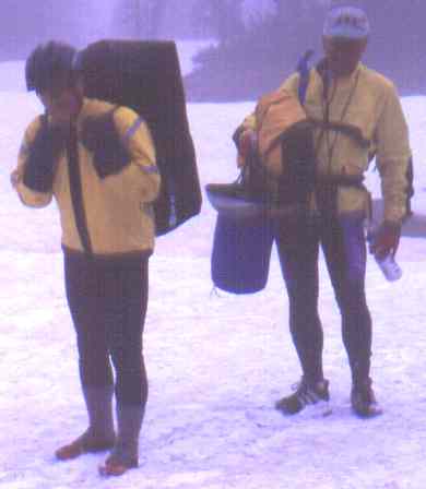
Sunday, dawned cloudy with a cold biting wind. We left the cabin around 8:00 AM after posing for a quick group photo at the cabin. The 4 kms descent from Jumbo to the west was steep, too steep to ride for the most part and for most people. But it was a smooth trail, with a couple of patches of snow at the start and with only a couple of deadfalls. In less than two hours, we reached the Glacier creek logging road. Paul, Mike and Len (a.k.a. 'the speedies') were ahead of us; our noble leader and Vic behind us. At the road, Jim and I stopped to clean the rims and brakes from all the mud. As Peter had promised, it was an easy 39 kms downhill all the way and very enjoyable, with great scenery.
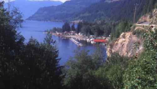
Soon we got to Cooper Creek and Duncan Lake. Now it was hot and the mosquitoes were having a banquet. We had gone from winter at the pass to summer in a few hours. At Cooper Creek, Vic had a flat (rear wheel, of course), to the delight of the ravenous mosquitoes who were lying in ambush. Later he told us that he had to sacrifice a whole bottle of repellent to be able to change the tube. The remaining 35 kms along Kootenay lake on Hwy. 31 was an enjoyable ride and by 6:00 PM, everybody was at the campground in Kaslo for a much-needed shower, beer and a five-course dinner. Somebody must have tipped off Kaslo about our trip for the whole town was celebrating our arrival with a jazz festival. Thank you Kaslo, a nice way to end of Day 2, only 78 kms and the easiest day of the whole trip.
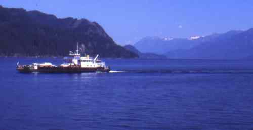
Day 3 was going to be a toughie, so we were off early and got to Balfour (36 kms) just in time to get on the ferry for coffee and pastry. At Crawford Bay, we again split into three groups: the speedies, keen to tackle Grey Creek Pass, took off while Vic, Jim and I stopped for a leisurely breakfast in preparation for the grueling climb up ahead. Peter, who had taken the time to change to road slicks in Kaslo, came on a later ferry.
By around 1 PM, we three slackers started the 13 kms (or so we thought, it is actually 18.5, all uphill) steep climb up the Grey Creek road. It was a hot day, not much shade on the west-facing road but fortunately with lots of water. After a couple of hours of mostly pushing the loaded bikes, interspersed with a little riding, we were all feeling the heat. At this point, Vic, who was also not feeling well, decided to hitch a ride from a passing pick-up. Jim and I were delighted to give him our packs to take up to the Pass where he would wait for us. A little lighter now, it was easier going with some sections that we could cycle but still mostly too steep to cycle. Soon, Peter passed us, comfortably seated in the front seat of anSUV; he stopped briefly to tell us that his rear wheel (the rim) broke shortly after getting off the ferry and he was going to Kimberley where he hoped to get it fixed.
Past the 7 km point, just when we figured that we were more than half-way up, the driver who gave Vic the ride stopped on the way down and casually broke the bad news to us: it was still a 11 kms to the pass, all up. What a bitter blow that was! Just below the Pass, we met a Swiss couple on a tandem who had cycled up from the other side and were setting up camp; they were on their way to Vancouver and had taken this route as a shortcut!
At 6:00 PM, Jim and I finally reached the summit to be greeted by a delighted Vic who was getting tired of being food for the mosquitoes and was wondering whether we would ever make it. The speedies had reached the Pass around 4:00 PM and were long gone. Mike had cycled all the way with his trailer and gear, a most impressive show of fitness.
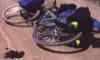
We wasted little time at the Pass as we still had 42 kms to go on a logging road, mostly downhill. From driving this road a few years ago, I remembered it as being a smooth ride and we were looking forward to an enjoyable ride down; unfortunately, this was not to be. The road was steep and rough and we had to stop every couple of kilometres to cool our rims and rest our aching shoulders and hands. It was frustrating trying to choose the best line, dodging the worst of the rocks. Shortly after 9:00 PM, as the light was fading and the road was leveling out, the axe fell. Vic's rear derailleur broke and was dangling limply from the bottom of the chain.
We thought that we could shorten the chain so he could cycle in one gear. When he removed the chain, we discovered that the damage was more serious. The bracket on the frame to which the rear derailleur used to be attached had been bent by the force of the blow into the rear sprocket so that the freewheel was no longer free. We tried to straighten the bracket with pliers but this proved to be impossible. Then we noticed that the nut at the end of the axle skewer had been blown off by the force of the blow.
At this point, it became clear that Vic's cycling trip was at an end, yet the highway was still about 35 kms away and it was getting dark. Just then a pickup truck came by and thankfully, the driver agreed to take Vic to Kimberley. Jim and I proceeded slowly and cautiously in the dark, thinking of Vic's mishap and our own vulnerability. We were now regretting the leisurely breakfast earlier in the day.
Soon we were down to the bridge over the St. Mary river, happy to have the rough road behind us. We decided to camp at the bridge, about 10 kms from where the others were camping and enjoying a bonfire. Day 3 had been a long one, we had cycled about 100 kms and climbed 1300 m to the Pass, the second hardest day of the trip. It was close to midnight by the time we got into our sleeping bags.
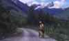
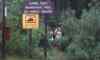
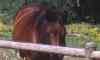
The rest was fast and easy (35 kms) along the St. Mary river road. Amazingly, we came across a family of mountain goats (not sheep), two adults and two kids, grazing on a rock slide next to the road. Soon we were on the paved part and an hour later Jim and I were sitting down to a good and leisurely breakfast in the Howard Johnson's in Kimberley. Just as we were leaving, Vic steps out of the elevator looking spiffy and clean with his bike neatly wrapped up, ready to thumb his way back to Panorama. We agreed that he would meet us at the campground for supper at Canal Flats, 69 hot kms away. That day was a real scorcher, the temperature hitting 35 degrees.
We passed Vic on the highway just outside Kimberley and we took a picture of him practicing his hitchhiking technique and looking cool. At Skookumchuk, we joined Peter at the local ice-cream parlour, cooling off and relaxing in the shade by a duck pond. Two kilometres out of Canal Flats, Vic was waiting for us in his car with cold bottled water, thank you Vic, that water was delicious! We then rode to the Kootenay River for a refreshing wash/dip in its ice-cold water and enjoyed the cold beer that Vic brought with him. A fitting end to Day 4; for Jim and I, it was about 117 kms. All seven of us were re-united for dinner and the inevitable post-mortem.
Day 5 was a relatively easy 72 kms, except for the final climb from Invermere to Panorama. To get to Invermere, we cycled the pleasant West side highway which had little traffic. We left our panniers at a gas station in Invermere, for the final 18 kms up to Panorama. We were back at the car by around 2 PM. The speedies waved to us from their cars on the way home as we cycled the last few kilometres and Peter was somewhere behind probably thinking of his next adventure, the 9-day Kettle valley trip.
In summary, we all agreed that this was a tough and rewarding trip. It traversed the rugged and scenic terrain of south BC, a great adventure, just as Peter had promised. We had excellent weather. There is no question that getting to Jumbo Pass is the crux and some thought that such a hike should not be included in a cycling trip, but this is a matter of opinion. I like mountain biking and hiking combination. In any case, Peter is already at work on an alternative plan that would deal with this objection. I think everybody enjoyed the trip even though we did curse a few times, and we are all glad to have done it. For Jim and I, it had worked out well and the only mishap we had was Jim getting stung by a bee! We even managed to get to Calgary before the washout closed the Trans Canada highway near Banff. It was unfortunate that Peter and Vic had bike breakdowns, especially Vic who was so near to the smooth section, but when I think about it, it is amazing that we did not have more mechanical problems consider
ing how much battering the bikes got.
Thank you Peter for planning the trip, and for doing all the organizing work. It was a great trip. One last question, would we do it again? I can best answer this by quoting the Japanese proverb: �He who has never climbed Mt. Fuji is a fool and he who has climbed it twice is also a fool.�
**************
Tour Co-Ordinator's Note: This was a great trip and we knew going into it was going to be challenging.
However, I would do it differently next time, perhaps in two to three years.
The changes I would make are as follows:
- Space the trip over six days instead of five
- Use a luggage truck so we would not have to ride with loaded bikes.
- We would not bring the bikes with us over Jumbo Pass.
Rather, we would simply backpack up the foot trail from the end of the Jumbo Creek forestry road to the hut at the summit ridge.
The next day we would continue back packing west down the foot trail to the start of the Glacier Creek forestry road.
To accomplish this, the lug truck would meet us at the end of the Jumbo forestry road at the end of day 1.
There, we would exchange our bicycles for back packs and only take what we needed for the overnight
in the hut. Through the afternoon of Day 1, the van would travel west via Gray Creek Pass
to the west side of the Jumbo Pass trail at the east end
of the Glacier Creek road. It would meet us there by late morning of Day 2 and we would do the exchange
again between the backpacks and bikes.
I would do this revised itineray for two reasons:
One, even though the Jumbo Pass trail on the west
side of the pass is in great shape in obviously 'trail crew constructed' fine condition, the trail up the east side
of the pass is steeper, rougher, wetter, and is too often a 'scramble' route.
Definitely not suitable for travel with
loaded bicycles. It is not easy to ride a loaded bicycle up a steep talus slope.
It took us two to three trips to get all our gear to the top.
And definitely a 'character building experience.'
Two, it is just too far to ride from Kaslo to St. Mary Lake in one day for most people. It is better to
end the day at the summit of Gray Creek Pass. There are two options for the overnight sojourn
there. The first is the BC Forest Service's Rec site at the summit. A nice little spot. The second is the
hut there that was constructed by the locals, probably primarily for overnighting for back country
skiiers in the winter.
My revised schedule would be as follows:
- Day 1: Panorama ski resort to Jumbo Pass
- Day 2: Jumbo Pass to Kaslo
- Day 3: Kaslo to Gray Creek Pass
- Day 4: Gray Creek Pass to Kimberley
- Day 5: Kimberly to north end of Columbia Lake
- Day 6: Columbia Lake to Panorama
|