|
|
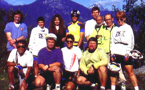
Year 1 - 1993 |
|
|
|
|
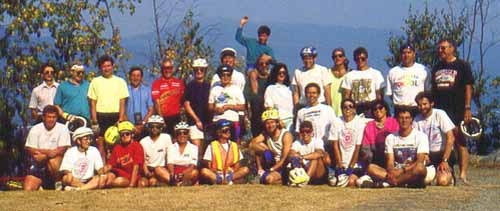
Year 2 - 1994 |
|
|
|
|
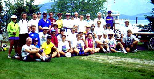
Year 3 - 1995 |
|
|
|
|
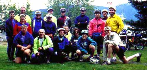
Year 4 - 1996 |
|
|
Slocan Triangle Cycle Tour 1993 - 1996
Webmaster: P. LaGrandeur....................This page last updated 2005 Jan 29
E-Mail: lagrandeurp@techworld.ca
|
|
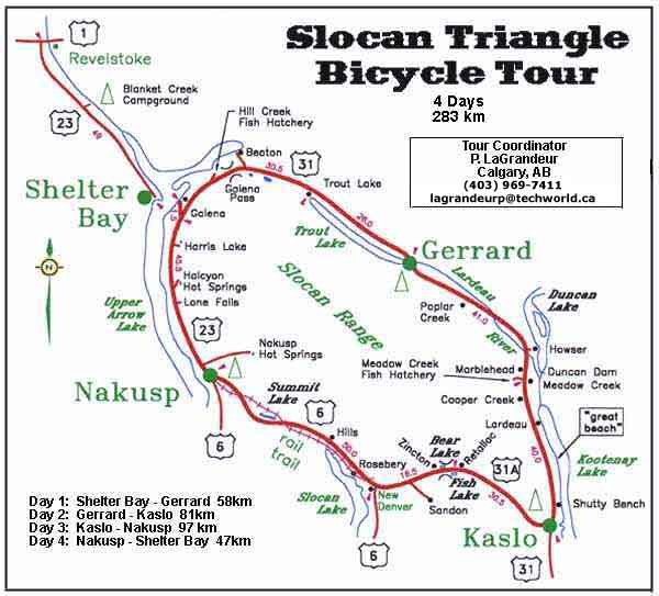
| Map of Slocan Triangle Bicycle Tour |
|
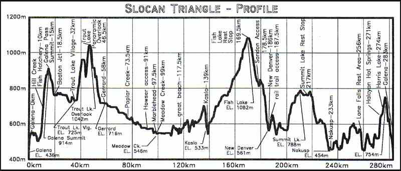
| Profile of Slocan Triangle Bicycle Tour |
|
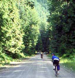
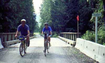
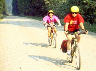
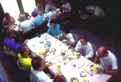
Pic's from Previous Slocan Trips.
Do you see yourself in any of the images?
|
|
|
^Patti & Brady at Windsor Hotel in Trout Lake Village |
^Neal on Salmon Spawning Observation Deck beside Lardeau River at Gerrard |
|
|
|
^Liz on Former Rail Road Grade beside Lardeau River at Gerrard. |
^Peter and Liz on Mobbs Creek Bridge beside Lardeau River, near Gerrard. |
|
|
|
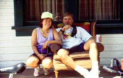
^Patti (L) and Lee Start Day 2 With a 40km Downhill Ride to Breakfast. |
^Elegant Dining at Drifter's Restaurant in Meadow Creek |
|
|
|
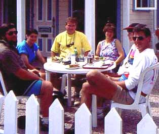
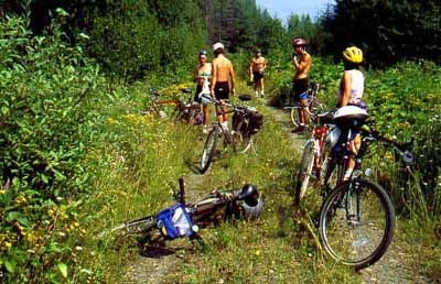
^Don, Liz, Peter, Darlene, Terry, Guido at Outdoor Cafe in Kaslo |
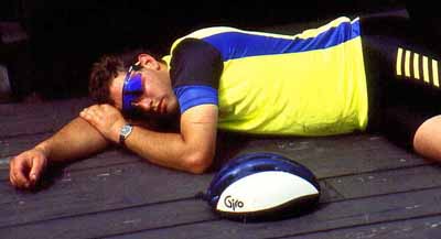
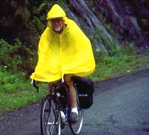
^Bill Ascending Pass in Rain to Fish & Bear Lakes at Summit. |
|
|
|
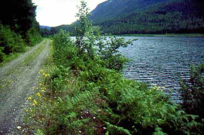
^Former Nakusp & Slocan Railway Now the Newly Developed "Galena Rail Trail" Near New Denver. |
^Former Nakusp & Slocan Railway Now the Newly Developed "Galena Rail Trail" Aside Slocan Lake. |
|
|
|
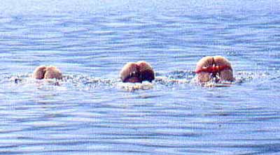
^A chance sighting of the three eyed rare Slocan Lake ogopogo. |
^A rest stop in the heat of the day along the New Denver/Nakusp rail trail. |
|
|
|
|
|
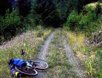
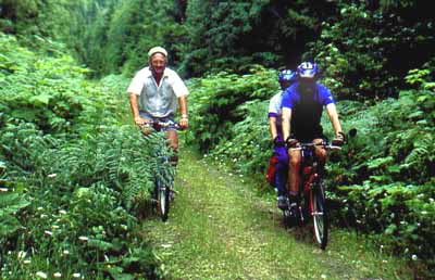
^These forest trails don't get any better than this. We can't wait to get to the hot springs! |
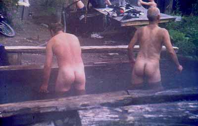
^Let's test the waters before we get right in. |
Slocan Culture & History
Historical Overview
The original inhabitants of the area may have arrived as far back as 9000 years ago, with evidence of such settlements along the shore of Slocan Lake. With the arrival of the white man’s plagues, most of the indigent peoples were wiped out by the 1870’s. The rest retreated to Washington state and were restricted from returning to what became Canada with the imposition of the U.S./Canada border. Mining activity came to the area in 1891 and petered out by 1920. The first paddle wheeler, the William Hunter, was launched on Slocan Lake in 1892. That era brought the steam powered trains and lake paddle wheelers. After them came orchard growers from England but these entrepreneurs had limited success due to their relative remoteness from markets. Then came the Russian pacifists known as the Doukhobours. During the Second World War, the Japanese internment camps were established in Lemon Creek, New Denver, Slocan City, Rosebery and Sandon. Some of these people have remained in the area ever since. In the
‘sixties and ‘seventies, a wave of society’s non-conformists arrived with their “back to the land” ideals and a desire for the area’s peaceful isolation. In the 1990’s, the Slocan area is a residence destination for persons from the cities seeking wilderness ambience along with modern conveniences.
Shelter Bay
Now the site of loading and disembarking for motor vehicles onto diesel powered ferries between Shelter Bay and Galena, directly across Upper Arrow Lake to the east.
Arrowhead
The southern terminus of the CPR line between there and Revelstoke, built to avoid the tricky navigating required for steam boats along the Columbia River. This was the northern end of the water route between Arrowhead and Trail. Formerly, the paddle wheeler route went as far north as Robson.
Galena
The new ferry terminal, replacing the former one around the corner to the north at Galena Bay.
Galena Bay
Site of the Bluebell mine and final resting place of the International paddle wheeler as a bunkhouse for same.
Hill Creek Fish Hatchery and Spawning Channels
Birthplace of Gerrard Rainbow Trout, Kokanee, and Dolly Varden. Each fall it is the final destination of half a million Kokanee salmon when they return to spawn here at the end of their life cycle. Kokanee are land-locked sockeye salmon. It was constructed in 1981 and is home to a year round staff of ichthyologists.
Trout Lake village
Originally known as Trout Lake City it was envisioned to be a centre for another feverish mining boom similiar to the previous one at Sandon. Rich ore finds failed to be found so little occurred in this region beyond the excitement of high expectations and dashed dreams. It is today a sleepy hollow among one of the remotest regions of south eastern British Columbia. Site of the Windsor Hotel, operated today by Albertans from Rocky Mountain House.
Trout Lake
Twenty six kilometres long and 900 ‘ deep in places, its waters were plied by the CPR’s paddle wheeler Victoria and the tug Proctor. These boats connected the CPR rail terminus at Gerrard with Trout Lake City. Trout Lake lies between the the Slocan Range and the Selkirk Mountains.
Gerrard
At the turn of the century, Gerrard was home to 40 persons. A railway extended north to it from Kaslo from 1902 to 1928. Today it is a ghost town with only a Provincial Park campground on the site of the former railroad switch yard. A track-side railroad shack still exists beside the former line next to the current day campground. Trout Lake is wonderfully warm for swimming. Cross the adjacent Lardeau River to a trout spawning observation deck. May is the time to observe the Gerrard trout-spawning activity. The unique feature of Gerrard Rainbow Trout is that they do not die after spawning. That is likely what contributes to them being so large. The record catch of a Gerrard is 16 kilograms (35.75 pounds) in the 1980’s. In the 1940’s there was a venture to export the Gerrards around the U.S.A.. This failed since this species failed to thrive anywhere except in Trout Lake, the Lardeau River and Kootenay Lake. The 300m long stretch of coarse, clean gravel below the Gerrard bridge is what makes the La
rdeau at Gerrard ideal for spawning. The hatchery building and residence were located at the east side of the head of the Lardeau River on the shore of Trout Lake. The hatchery building was removed in 1994. A permanant fishing ban exists on the Lardeau River and its tributaries. Dolly Varden spawn below the bridge at Gerrard in September. Kokanee salmon, Dolly Varden char and Gerrard trout all reside and mature in Kootenay Lake, considered to be a trophy lake, downstream/south of Gerrard.
Lardeau River
A Class II destination for canoeists at lower levels, it offers intermediate and some advanced paddling. A medium volume, small rock river with frequent braided sections. Many log jams represent serious hazards for paddlers but afford wonderful shaded retreats for resident fish. Logjam locations and extents change from day to day so each new trip down the river can be a new experience. Peak runoff time is June with a recorded usual maximum volume of ~200 m/s (~8000 cfs). Paddling season is May to September. Fed by snow melt, glacial melt and rain. Average gradient is 5m/km or 25'/mi..
CPR “Kootenay and Arrowhead Railway”
Technically termed the Lardeau Subdivision, this 53 kilometre line extended along the Lardeau River and Kootenay Lake between Gerrard and Lardeau. Completed in 1902 in anticipation of a mining boom in the Trout Lake region which never materialized. A proposed line between Trout Lake City and the north east arm of Upper Arrow Lake was never built. Steam powered paddle wheelers operated between Gerrard and Trout Lake City. Built by the CPR It saw little traffic and weekly service was discontinued in 1920. A converted road truck replaced it until 1942 when the trackage was abandoned and the right of way became a narrow gravel road. The CPR barged its trains between Proctor and Lardeau. When first constructed, it was in initial feverish competition with the Great Northern Railway’s Kaslo and Lardo-Duncan railway which, though surveyed, never was constructed.
Poplar Creek
Originally a whistle stop along the K&A Railway. Now the site of a few cabins.
Howser
Formerly spelled "Hauser", after an area pioneer in the 1860’s. Now a quiet village on the edge of the artifically raised Duncan Lake, with a newly constructed boat launch ramp on its shore.
Marblehead
Originally a whistle stop along the K&A Railway it had a passenger station, which still exists today as a dwelling for local residents. It is also the location of a sawmill, the burner for which still remains across the rail road right of way.
Kootenay Lake
Steam powered vessels such as the Kaslo, International, Alberta, Argenta, Moyie, S.S. Moyie, and Kuskanook churned their way through the waters of this large lake in the days of the mining booms. The Argenta was of very shallow draft and was used to travel up the Duncan River to Duncan Lake. Their existence lasted until the late 1950’s. Ports of call around the lake included Kaslo, Proctor, Kuskanook, Argenta, Lardeau, Mirror Lake, Nelson, and Kootenay Landing. The Great Northern Railway’s steam boats connected the Kootenay Lake area with the Bonner’s Ferry area in Idaho, U.S.A..
Lardeau
Originally spelled Lardo, it was the southern terminus of the CPR’s Kootenay and Arrow Railway and the northern terminus of the CPR’s steamboat service from Proctor and Kaslo.
Shutty Bench
Named after four brothers named Shutty who worked as section men on the Kaslo and Slocan Railway.
Kaslo
Kaslo was incorporated as a city in 1893, when the Dominion of Canada was still a remote frontier in the British Empire. Silver mines, logging, freight and commerce were its mainstays. Fire, floods and storms devastated Kaslo in 1894, but, as with most frontier towns, it was soon rebuilt. Victorian architecture still is evident throughout the town. Its striking Victorian city hall is one of the two remaining wooden city halls in Canada. An often mist-covered Kootenay Lake laps at the base of snow-covered mountains. The real S.S. Moyie paddle wheeler (not the one on the Glenmore reservoir in Calgary) now resides on stilts in town on the lakeshore, retired in 1957. It is the world’s oldest intact passenger stern wheeler. It is now a national historic site with an adjoining interpretive centre. Tours are available through its refurbished interior.
Silvery Slocan
The areas around Idaho Peak and Payne mountain were the focal point of one of British Columbia’s great but short-lived mining booms in the 1890’s. This region, between New Denver and Slocan Lake on the west side, and Kaslo and Kootenay Lake on the east, was in the Slocan Mountain Range. Silver, lead, and zinc were the treasure unearthed here. These mines, in a perilously steep and rugged mountain wilderness, yielded wealth to a few and a living to many.
Great Northern Railway “Kaslo and Sandon Railway”
Now technically known to the CPR as the Kaslo Subdivision, this 47.5 km narrow gauge track was built as a supply and out-freight line along the Kaslo River and Carpenter Creek between Kaslo and Sandon. A 5 km spur line branched off just before Sandon to go to Cody, another mining town. Less than one year after the discovery of ore in the Slocan range, the Kaslo & Slocan Railway was incorporated in 1892 by an act of the B.C. legislature. Typical of narrow gauge track, it had short ties, light gauge 45 lb. rails, short radius curves, and narrow cuts. Grades reached a maximun steepness of 3.25%. Waypoints included South Fork/Nashville (later CPR’s Zwicky), 12 Mile Creek (later CPR’s Adamant/Keen), Sproules (later CPR’s Blaylock), Bell’s Siding, Whitewater (later CPR’s Retallack), Wellington Spur, Watson (later CPR’s Giegrich), Bear Lake, Lucky Jim (later CPR’s Zincton), McGuigan Siding, Payne Bluff, Payne Mine concentrator, Cody Junction and Wood. On the Cody spur were Reco Spur and Last Chance. As with
the CPR’s Nakusp & Sandon Railway, the K&S suffered greatly from nature’s mountain terrain onslaught of avalanches, landslides, floods and forest fires. Its mainstay was carrying out the silver, lead and zinc ore to the smelters, connecting with paddle wheelers to finish the journey. It was eventually taken over by the CPR in 1912 and converted to a a standard gauge track with 80 lb. rails. The alignment between Zincton and Payne Bluff was relocated to the other side of Seaton Creek and joined the original CPR N&S line into Sandon just above Three Forks. The former K&S line from Lucky Jim (Zincton) to Sandon was abandoned. The trackage between Kaslo and Sandon was abandoned in 1955 after extensive flooding and track damage.
Retallack
The site of the Whitewater mine. Originally named Whitewater by the K&S Railway, it was renamed after Major John Ley Retallack, secretary of the Kaslo Syndicate which assumed ownership of the K&S.
Fish Lake
Site of the Bear Lake Hotel. Bear and Fish Lakes have had their names switched since pioneer times. Now the site of a roadside rest stop on a small point at the east end of the lake. The hotel was across the road and about a hundred meters to the west of the point.
Bear Lake
The railroad originally ran along the opposite side of the lake from where it finalized its route and where the present day highway is.
Zincton
Formerly known as Lucky Jim, a mine site.
Sandon
At one time, Sandon was the silver mining capital of Canada. Founded in the 1890’s it was incorporated as a city in 1898. Its population soon grew to 5000. B.C.’s first hydro-electrical power generating plant was established and still operates to this day.
Situated in a short, narrow valley it soon became cramped within its boundaries. Before long, Carpenter Creek, running through the city, was enclosed within a flume, and covered over with a boardwalk and buildings. The closely-built structures of the town burned to the ground in less than two hours on May 4, 1900. The city was soon reconstructed. Forest fires, avalanches and land slides ravaged the rail lines on a regular basis and often damaged the railroad to the extent that service was temporarily suspended.
By 1920, most mining activity had died out due to ore depletions and declining silver prices. WW II saw Sandon as a site for one of the Japanese internment camps. A brief revival of Silver mining brought back a flurry of activity in the early 1950’s. In the spring of 1955, an avalanche blocked the creek upstream of town. A lake soon filled the valley behind this snow dam until it suddenly burst, unleashing a tidal wave unto the hapless inhabitants below. The town was devastated, either destroying most of the buildings or moving some of them down stream. That was the end of the existence of Sandon. After that, only a handful of residents remained. The present day museum and gift shop is one of these so-transported buildings.
Nearby Silverton, New Denver, Nakusp and Kaslo were gateways for supply routes to Sandon. Many local trails abound and are suitable for hiking, cross-country skiing and snowmobiling. Adjacent Idaho Peak, accessed by a steep but driveable 12km trail, puts you on top of the world. View the Valhalla and Kokanee Provincial Parks.
Some of the local mines were Slocan Star, Reco, Payne, Ruth, Last Chance, Whitewater, Rambler, Dardanelles, Alamo, Lucky Jim, Noble Five, and Jackson. Production peaked in 1918.
CPR “Nakusp and Slocan Railway”
This 67 km section of track between Nakusp and Sandon was completed in 1895. Waypoints included the Payne mine concentrator, Three Forks, Alamo, Denver Canyon, New Denver, Rosebery, Hills, Summit Lake, and Brouse. From a high point at Summit Lake, it descended to Nakusp and Hills on each side at a slope of 2.5%. A level grade from Hills brought it to Rosebery where it commenced the final climb to Sandon with slopes of up to 4.8%. As with the GNR’s Kaslo & Sandon Railway, the N&S suffered almost as much from nature’s mountain terrain onslaught of avalanches, landslides, floods and forest fires in the Denver Canyon stretch. Rosebery was the site of a transfer dock where rail cars were exchanged between land and barges. The trackage between Nakusp and Sandon was abandoned in 1955 after extensive flooding and track damage in the Denver Canyon area. After the amalgamation of the K&S and the N&S, the two segments became collectively known as the Kaslo Subdivision. That railway right-of-way is now the bike a
nd hike trail used by recreational tourers between Carpenter Creek and Nakusp. The trestle over Arthur Creek near Hills has been removed so trail users must hump their way down to the creek and back up the other side. The segment between Carpenter Ck. and Sandon is still somewhat passable. No bridge exists over Carpenter Creek. Trail users must go around to the Sandon road to access the other side of the path.
Three Forks
The junction of Kane, Seaton and Carpenter Creeks was the stepping off point for the leg between there and Sandon. A site of track washouts.
Alamo
One-time site of a large ore concentrator.
New Denver
New Denver is home to the Silvery Slocan Museum, located in the town’s former first bank, and the Nikkei Internment Memorial Centre. This municipality was founded as a west entrance to Sandon in 1892.
During the Second World War, the town was home to 1500 interned Nikkei (persons of Japanese descent). 22,000 of them that had been living within 100 miles of the west coast lost their civil rights and were relocated, against their will, to camps in the Slocan Valley of B.C., the sugar beet farms of Alberta, and to work camps in Manitoba and Ontario. Nearby Lemon Creek, Sandon, Slocan City and Rosebery accommodated the Nikkei as well. In ND, they were compounded in a former orchard on the south side of Carpenter Creek near the lake shore. Living in tar paper shacks, their existence was miserable through the cold winters. At the conclusion of the war, over half stayed in New Denver with the rest returning to Japan or migrating east of the Rockies. The local Kyowakai Society has remained to this day and has built an impressive memorial centre, a “must-see” for passers by. Located at 306 Josephine Street, it is open from 09:30 - 17:00 each day from May 15 to October 15.
Slocan Lake
Slocan Lake experienced much steam-powered paddle wheeler traffic between the points of Rosebery, New Denver, Silverton, and Slocan City. Included in the steam boat fleet were the Iris G. and the Rosebery. The latter operated until 1956.
Rosebery
The site of a CPR rail/barge transfer dock and a WW II Japanese Canadian internment camp. A provincial park campground sits on the bank of nearby Wilson Creek. On Jan. 1, 1947, a locomotive, several cars, a caboose and a snowplow rolled off a barge near here into water too deep to be salvaged.
Nakusp
Now a town of 2000 residents, Nakusp was originally established at the time of the Slocan silver rush in the 1890’s. It is on the shore of Upper Arrow Lake at an elevation of 454m above sea level. The fertile and sheltered valley has been home to fruit and vegetable growers plus a base for the logging industry. Many expected it to become another boom town with a silver smelter, however, these hopes fell through when the facility was built in Trail. A railway was constructed between Nakusp and Sandon in 1893 and carried ore from the remote mountain town to Nakusp where it was loaded onto steamers and transported down the Columbia River to Trail. Nakusp boasts a panoramic waterfront with beach, developed hot springs on the mountain above town, the Japanese Garden, and a museum at the village office. The musem displays artifacts from the Salish Indian population that originally inhabited the area.
Upper Arrow Lake
Steam boats on this lake included the Bonnington and Minto.
Lone Falls
Formerly a half way point point on the trail between Nakusp and the Galena Bay ferry terminus, hence the name for the nearby river, Halfway River. A rest stop has been situated here next to the high falls, a welcome stop for cyclists puffing their way through the rolling hills of Hwy. 23.
Click Here to Return to Top of Page
|
|
|
|